Introduction
As cities & urban centres become denser and vehicle ownership continues to rise, existing parking infrastructures struggle to keep pace. Manual parking management often leads to untracked vacant slots, missed revenue opportunities for operators, and a poor experience for drivers.
Though technology-driven camera-based solutions are widely adopted, they frequently underperform in challenging real-world conditions such as low light, rain, or partial obstruction. They also entail high installation and maintenance costs, especially across large or multi-level parking facilities.
LiDAR-based smart parking systems are emerging as a superior alternative offering higher reliability, reduced maintenance, and improved scalability, ultimately driving a lower total cost of ownership. In this case study, we describe how MulticoreWare partnered with a leading 3D Sensing technology customer to design and implement a LiDAR-based Parking Management System delivering a technically robust and scalable approach to modernise urban parking infrastructure.
Client
The client is a leading provider of advanced 3D-based sensing hardware and infrastructure solutions. Their portfolio spans smart transportation, industrial automation, and intelligent infrastructure systems, leveraging advanced optical and LiDAR sensing to deliver accurate contextual perception.
Challenge
Urban and commercial parking facilities face significant challenges such as:
- Inefficient manual supervision, resulting in underutilised spaces and increased operational overhead.
- Lack of real-time vehicle tracking and occupancy insights, resulting in limited visibility and delayed responsiveness.
- Heavy reliance on camera-only solutions, resulting in privacy concerns and performance limitations.
- Lack of seamless integration with mobile apps, web dashboards, and enforcement systems hinders automation and degrades overall user experience.
The client sought to implement an automated, scalable, and modular LiDAR-based Parking Management System to offer real-time vehicle detection, dynamic occupancy mapping, and API integration for seamless enforcement and data analytics.
MulticoreWare Solution Overview
1. Modular ROS 2-based Architecture
We built ROS 2 Humble nodes for preprocessing, filtering, clustering, and tracking. On target hardware, the pipeline sustains 10 Hz end-to-end with 10 FPS LiDAR ingest. The design can scale multiple LiDARs, with hot restarts in ≤ 10 s.
2. Sensor Fusion & Filtering
We calibrated and synchronized multiple 3D LiDARs to provide comprehensive coverage, maintaining extrinsic calibration residuals of ≤ 3 cm and ≤ 0.5°, and a time-synchronization skew of ≤ 5 ms. The automatic ground plane detection enables tilt compensation within ≤ 0.5° residual. Only points inside configured parking-lot regions (ROIs) are forwarded to clustering and detection.
3. Intelligent Algorithm Design for Real-time deployment on Industrial PCs
MulticoreWare has developed a custom algorithm that uses pose-aware geometric features within a modular, scalable framework. This design allows it to scale seamlessly and incorporate sensor fusion, improving reliability in complex environments. When parking blueprints or similar prior information are available, the algorithm can use them to further improve accuracy in complex layouts (angled, parallel, perpendicular). It is carefully optimized to run efficiently in real time on Industrial PCs.
4. Cloud Integration
The Parking Management System publishes parking status and vehicle events to the cloud over secure HTTPS, creating a live view of every slot across sites. In the cloud, a real-time model of each lot powers REST and WebSocket endpoints for apps, dashboards, and third parties.
Payload (example):
{
  “row_ID: “2009”
  "lot": "T1",
  "slot": "A-17",
  “slot_coordinates: [18.95, -25.91], [-11.30, -25.45], [-12.22, -4.33], [26.23, 6.74]”
  "status": "occupied",
  "event_id": "v13s12k1988-504",
  "t_enter": "2025-09-21T12:34:56Z",
  "confidence": 0.97
}
5. Visualization & Debugging Tools
A Qt-based UI provides live monitoring of LiDAR point clouds, detected vehicle positions, and real-time occupancy across all slots at 10 FPS, with time-based analytics and logging. The tool also supports playback at 10 Hz and ships as a portable .deb package for streamlined deployment.
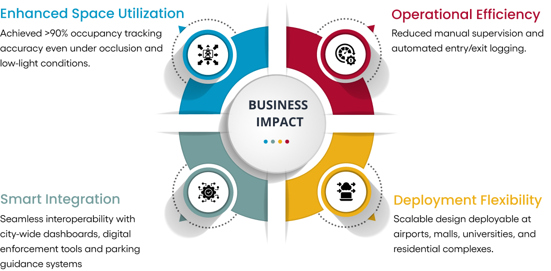
Business Impact
With deep expertise in AI and sensor fusion, MulticoreWare can custom-design end-to-end solutions optimized for real-time embedded deployment.
To explore how MulticoreWare can help you build customised Intelligent Transportation solutions with advanced AI and sensing, reach out to info@multicorewareinc.com